Heavy Storms Roll Through Central MN, Prompting Multiple Warnings
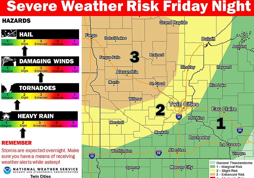
ST. CLOUD -- Significant thunderstorms with the potential for high winds moved through central Minnesota late Friday night and early Saturday morning, prompting the National Weather Service to issue numerous warnings and watches.
Large portions of central Minnesota, including Stearns, Benton and Sherburne Counties, were under a Severe Thunderstorm Warning as the storm system picked up speed, making its way down from the northwestern part of the state. The warning expired shortly after 1:00 a.m. for most parts of the tri-county area, with southeastern Stearns County remaining on the list until 2:00 a.m.
A Tornado Warning was also issued briefly for west central Stearns County.
The massive storm system will continue to drop rain throughout Minnesota into Saturday morning. An excessive heat watch will kick in Saturday morning at 11:00 a.m., with heat indices reaching between 100 and 110 degrees.
More From 96.7 The River