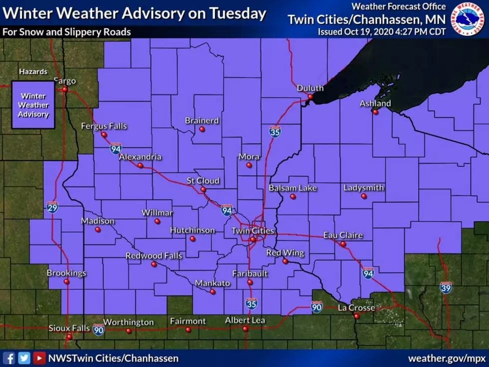
Winter Weather Advisory
The National Weather Service has issued a Winter Weather Advisory for Central Minnesota in effect from 7 AM Tuesday morning through 7 PM Tuesday night.
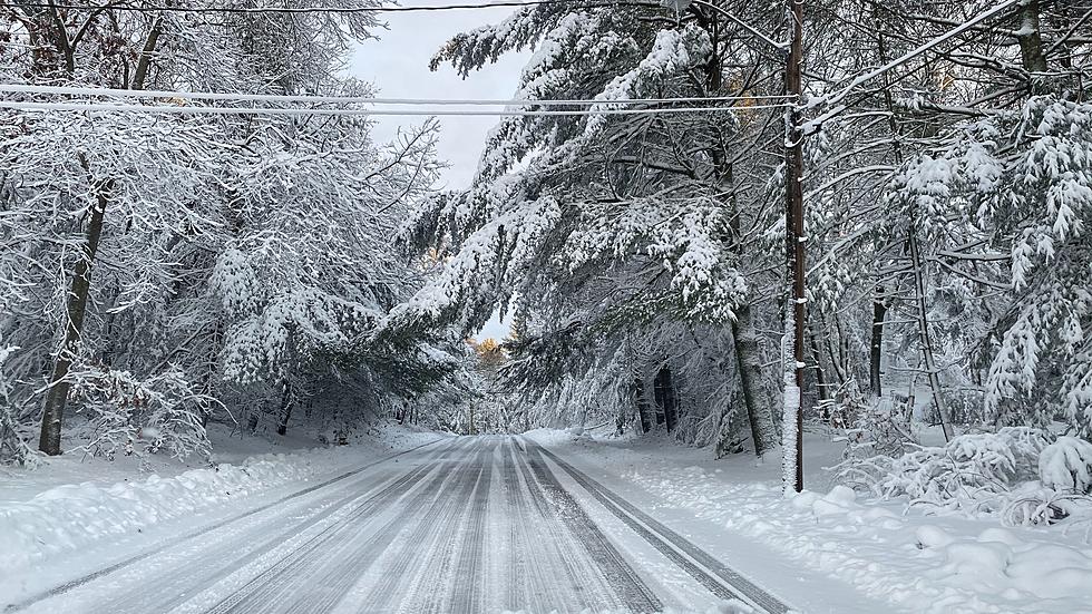
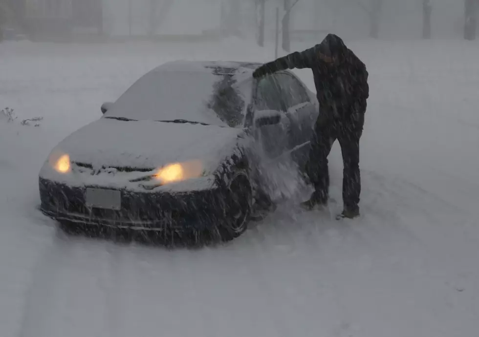
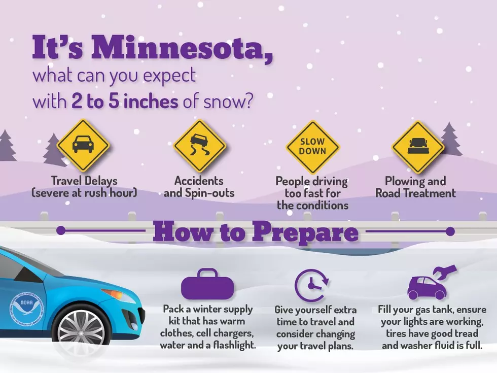
Three to five inches of snow is expected across the area. Plan on slippery road conditions that could impact the morning or evening commute, so allow for extra time to reach your destination on the first significant snowfall of the season.
The Winter Weather Advisory includes Benton, Mille Lacs, Morrison, Sherburne, Stearns, Wright and more counties -- including the Twin Cities metro area.

An area of snow will move from west to east across the area on Tuesday with widespread snowfall amounts of 2 to 5 inches expected. Locally higher amounts are possible, particularly along the I-94 corridor. The afternoon commute will be impacted, so plan for additional travel time.
The official National Weather Service forecast for Saint Cloud Tuesday says: Snow, mainly after 9am. The snow could be heavy at times. High near 33. Southeast wind 5 to 15 mph. Chance of precipitation is 100%. New snow accumulation of 3 to 5 inches possible.

The 2020-2021 winter weather outlook from NOAA says Minnesota can expect near normal temperatures and above normal snowfall for the winter ahead. Looks like we're getting off to a healthy start.

The heaviest snow will fall between Noon and 6 PM Tuesday afternoon. Snowfall rates of ½+ inch per hour are likely Tuesday afternoon, with visibility less than a mile. Allow extra time for travel. Snow will end Tuesday evening.
The average high for this date is 56°.
Pete Hanson is on 98.1 Minnesota's New Country weekday mornings from 5:30 to 10:00.
10 Animals in Minnesota That Can Predict the Weather
More From 96.7 The River